Infiltration BMP Design Criteria Matrix
Infiltration BMPs should be designed according to the requirements listed in the table and footnotes below.
| Design Parameter | Unit | Basins & Trenches | Galleries | Bioinfiltration | Permeable | Dry Welld | Hybrid Bioretention/ |
|---|---|---|---|---|---|---|---|
| Design Capture Volume, Vcapture | cubic feet | Volume of water produced by the stormwater quality design storm event as | |||||
| Design Drawdown Time | hrs | At surface = 48 | |||||
| Setbacks and Elevations | - | In accordance with the Infiltration Feasibility Criteria and current Stormwater Informational Bulletin. | |||||
| Pretreatment | - | Appropriate Treatment Control Measure shall be provided as pretreatment for all tributary surfaces. | |||||
| Hydraulic Conductivity, Ksat,measured | in/hr | Measured hydraulic conductivity at the location of the proposed BMP at the depth of the proposed infiltrating surface (or effective infiltration rate where multi directional infiltration is occurring). The minimum required measured value shall be 0.3 in/ hr. | |||||
| Factor of Safety, FSb | - | 3 | |||||
| Facility geometry | - | Basin: Bottom slope ≤ 3%; | Flat bottom slope | Bottom slope ≤ 3%; | Pavement slope ≤ 5%; If ≥ 2%, area shall be terraced | Typical 18 – 36 inch diameter; flat bottom slope | Bioretention: Bottom slope ≤ 3%; side slope ≤ 3:1 (H:V) |
| Ponding Depth | inch | 18 (max)c | - | 18 (max)c | - | - | 18 (max)c |
| Media Depth | feet | 2 (min) | - | 2 (min) | 2 (min) | - | 2 (min) |
| Washed gravel media diameter | inch | 1 – 3 | - | - | 1 – 2 | 3/8 – 1 | 3/8 – 1 |
| Inlet erosion control | - | Energy dissipater to reduce velocity | |||||
| Overflow device | - | Required if system is on-line and does not have an upstream bypass structure. Shall be designed to handle the peak storm flow in accordance with the Building and Safety code and requirements | |||||
| |||||||
Flow Rate and Volume Calculation Example
Volume must be calculated for each tributary area to size each BMP.
- Sample Project Name: Commercial Site (Intersection of Western Ave. and Washington Blvd.)
- Provide proposed project characteristics
- ATOTAL − 1.15 Acres
- Type of Development − Commercial
- Flow Path length − 200 ft.
- Flow Path Slope − .01 (1%)
- % of Project Impervious − 87%
- Predominate Soil Type # − 13
- Design Storm* − 85th percentile
- * Projects are required to use the larger of the Stormwater Quality Design Storm.
- The volume of runoff produced from a 0.75-inch (or 0.0625 ft) storm event, or
- The 85th percentile, 24-hr runoff event at this location = 1.1 inch (or 0.91 ft)
- * Projects are required to use the larger of the Stormwater Quality Design Storm.
- Provide proposed project characteristics
Refer to LA County Hydrology GIS Map (https://dpw.lacounty.gov/wrd/hydrologygis/)
Determining the Peak Mitigation Flow Rate (QPM)
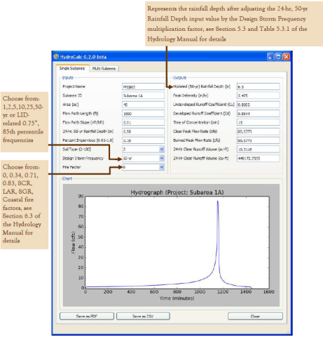
In order for the site designer/engineer to calculate runoff rate and volumes from the water quality storm, customers should download Los Angeles County's HydroCalc Calculator.
Determining the Volume (VM)
In order to determine the volume (VM) of stormwater runoff to be mitigated from the new development, use the larger storm volume from the following equation(s):
- 0.75 in Design Storm: VM (ft3) = ( 0.625 Ft ) • Catchment Area (Sq. Ft)
- 85th Percentile Design Storm: VM (ft3)) = (Storm Depth (Ft ) ) • Catchment Area (Sq. Ft)
- Refer to LA County Hydrology GIS Map (https://dpw.lacounty.gov/wrd/hydrologygis/) and the LA County Analysis of 85th Percentile 24-hour Rainfall Depth Analysis Within the County of Los Angeles
From example, 1.1 inch > 0.75 inch, use
1.1 inch (0.91) Design Storm:
- AI = 1.0 acres
- AP = 0.15 acres
- VM (ft3) = ( 0.091 ft ) • Catchment Area (in ft2)
- Catchment area ( ft2 ) = (impervious area • 0.9)+ [(pervious area + undeveloped area) • 0.1]
- Catchment area ( ft2 ) = 43,560 ft2 • [(1 ac • 0.9)+ [(0.15 ac) • 0.1] = 39,857.4 ft2]
- VM (ft3) = ( 0.091 ft ) • 39,857.4 ft2
- VM= 3,627 ft3 (verify results with Hydrocalc results)
- VM (ft3) = ( 0.091 ft ) • Catchment Area (in ft2)
BMP Type and Size
List the BMP Type(s) to be used in managing the calculated VM , and size it per the design criteria listen in BMP Prioritization and Selection. The following examples have been provided as a reference:
- Infiltration BMPs:
- Infiltration Trench
- Dry Well
- Infiltration Basin
- Capture and Use
- Above / Below Grade Cisterns
- Biofiltration
- Vegetated Swale
- Planter Box
- Biofiltration with underdrain
BMP - Design for At Grade Infiltration Trench
Givens:
|
|---|
1. Determine Ksat, Design
$K_{Sat, Design}=\frac{K_{Sat, Measured}}{FS}=\frac{2 in/hr}{3}=.667 in./hr.$
2. Determine Minimum Bottom Infiltration, Amin
$A_{min}=\frac{V_m\cdot 12in/ft}{K_{Sat,Design}\cdot T}$
$A_{min}=\frac{3,627 ft^3\cdot 12in/ft}{0.667 in/hr \cdot 48hr}= 1,359ft^2$
3. Determine 3-hr infiltration volume, V3-hr
$V_{3-hr}=A_{min}\cdot \left(\frac{K_{Sat, Design}}{12 in/ft}\right) \cdot 3hrs = 1,359 ft^2 \cdot \frac{0.667 in/hr}{12 in/ft} \cdot 3hrs = 226 ft^3$
4. Determine the volume stored within the trench, VTrench Storage
$V_{Trench Storage}=\frac{V_m}{Void Ratio}=\frac{3,627 ft^3}{0.4}=9,067 ft^3$
5. Determine remaining volume of storage required
$V_{Storage} = V_{Trench Storage} - V_{3-hr} = 9,067 ft^3 - 226 ft^3 = 8,841 ft^3$
6. Determine Design Depth
$D_{Design} = \frac{V_{Storage}}{A_{min}}=\frac{8,841 ft^3}{1,359 ft^2}= 6.5 ft$
BMP - Design for Below Grade Dry Well
Givens:
|
|---|
1. Required Dry well depth for the infiltration zone, h
$h=\frac {A_{min}-\pi r^2}{2\pi r}$
$h=\frac {934 ft^2 - 28.26 ft^2}{18.84 ft} = 48ft$ *
*Multiple dry wells may be used to achieve the equivalent infiltration zone.
2. Determine the dry well storage volume, VStorage:
(assuming entirely filled with gravel)
$V_{Storage Dry Well} = V_{Dry Well} \cdot \text{Void Ratio}$
$V_{Storage Dry Well} = [\pi r^2 h] \cdot 0.4 = [\pi \cdot \left(3ft\right)^2 \cdot 48 ft] \cdot 0.4 = 543 ft^3$
3. Determine 3-hr infiltration volume, V3-hr
$V_{3-hr}=A_{min} \cdot \frac{K_{Sat, Design}}{12 in/ft} \cdot 3 hrs = 1,359 ft^2 \cdot \frac{0.667 in/hr}{12 in/ft} \cdot 3 hrs = 156 ft^3$
4. Determine the additional required storage volume, VAdditional Storage
In order to satisfy the additional storage requirement, an upstream cistern or additional dry well chambers can be used. Some proprietary systems may provide additional storage capacity. Coordinate with manufactures.
$V_{Additional Storage} = V_m - \left( V_{Storage Dry Well} + V_{3-hr} \right) = 3,627 ft^3 - \left( 543 ft^3 + 156 ft^3 \right) = 2,928 ft^3$
2,928 ft3 of additional storage is required.
Infiltration BMP – Design for Below Grade Infiltration Basin
Givens:
|
|---|
1. Determine the design infiltration rate, KSat,Design
$K_{Sat, Design}=\frac{K_{Sat, Measured}}{FS}=\frac{2 in/hr}{3}=0.667 in/hr$
2. Determine Minimum Bottom Infiltration, Amin
$A_{min}=\frac{V_m \cdot 12in/ft}{K_{sat, Design}\cdot T}$
$A_{min}=\frac{3,627 ft^3 \cdot 12in/ft}{0.667 in/hr \cdot 96hr} = 680 ft^2$
3. Determine the Basin Design, DBasin
$D_{Basin}=\frac{V_{Storage}}{A_{min}} = \frac{3,627 ft^3}{680 ft^2} = 5.3 ft$
Capture and Use Design
Givens:
|
|---|
1. Determine the design volume in gallons:
$V_{Design} \left( gal \right) = 3,627 ft^3 \cdot 7.48 gal/ft^3 = 27,130 gal$
2. Determine planting area (ft2) within project limits
$\text{Planting Area} \left(ft^2\right) = 0.15 ac \cdot 43,560 ft^2 /ac = 6,534 ft^2$
3. Determine Planting Factor, PF, (ft2) (Planting factor may vary based on landscape design and plant types. Coordinate with Landscape Architect)
$\text{Planter Factor} \left(ft^2\right) = 0.4\cdot 6,534 ft^2= 2,614 ft^2$
4. Determine the 7- month (Oct 1 – April 30) Estimated Total Water Use (ETWU)
$ETWU_{\left(7month\right)} = ET_7 \cdot 0.62 \cdot PF$
$ETWU_{\left(7month\right)} = 21.7 \cdot 0.62 \cdot 2,614 ft^2= 35,163 gal$
5. Verify ETWU(7-month) is greater than or equal to the VDesigned
$ETWU_{\left(7month\right)} = 35,163 gal \geq V_Design \left(gal\right) = 3,627 gal$
∴ CAPTURE AND USE IS FEASIBLE
Biofiltration BMP – Design for Vegetated Swale
In addition to the "givens" below and depending on the location of the swale, LADBS Grading Division may need to approve a geotechnical report.
Swales shall be designed with a trapezoidal channel shape with side slopes of 3:1 (H:V). They shall incorporate at least two feet of soil beneath the vegetated surface. The following steps shall be followed for swale sizing. As is the case with other biofiltration BMPs, the sizing criteria presented below must be met.
In order to determine the swale base width and corresponding unit length, the base width of a swale must be between 2 and 10 feet. The designer may select the base width that is most appropriate for the site, but the swale length (per unit catchment area) must meet the minimum requirements as shown in the table below.
Givens:
|
|---|
1. Determine the swale base width and corresponding unit length:
Design the swale base of 5ft with corresponding unit length of 470 ft/ac.
2. Determine the total swale length
$L_{Swale \left( ft \right)} = 1.5 \cdot \text{Catchment area} \left( ft^2 \right) \cdot \left( \frac{1 acre}{43,560 ft^2 } \right) \cdot \text{Swale length per catchment area} \left( \frac{ft}{acre} \right)$
$\text{Catchment area} \left(ft^2 \right) = \left(\text{impervious area} \cdot 0.9 \right) + [\left(\text{pervious area} + \text{undeveloped area}\right) \cdot 0.1]$
$\text{Catchment area} \left(ft^2 \right) = 43,560 ft^2 \cdot [\left(1 \cdot 0.9 \right) + [\left(0.15 + 0\right) \cdot 0.1]]$
$\text{Catchment area} \left(ft^2 \right) = 39,857.4 ft^2$
$L_{Swale \left( ft \right)} = 1.5 \cdot 39,857.4 ft^2 \cdot \left( \frac{1 acre}{43,560 ft^2 } \right) \cdot 470 \frac{ft}{acre}$
$L_{Swale\left(ft\right)} =645 ft$
If there is adequate space on the site to accommodate a larger swale, consider using a greater length to increase the hydraulic residence time and improve the swale’s pollutant removal capability. If the calculated length is too long for the site, the layout may be modified by meandering the swale or increasing the base width of the swale up to 10 feet. The total swale length shall never be less than 100 feet.
3. Determine the Distance Between Check Dams
For volume storage, swales must incorporate check dams at specified intervals depending on the longitudinal slope of the swale, which must be between one and six percent. The check dams must be 12 inches in height and include a 6 inch deep notch in the middle of the check dam that is between one and two feet wide. All check dam structures shall extend across the entire base of the swale. They may be designed using a number of different materials including concrete blocks, gabions, gravel bags, rip rap, or earthen berms. The distance between successive check dams shall be determined from the longitudinal slope of the swale in the flow direction. The table below summarizes the design distances between check dams based on slope.
4. Determine the Total Number of Check Dams
$Total \# of dams = \frac{645}{33} = 19.5 \rightarrow \text{use 20}$
Planter Box Design
Givens:
|
|---|
1. Determine Design Volume
$V_{Design} \left( ft^3 \right) = 1.5 \cdot V_m$
$V_{Design} \left( ft^3 \right) = 1.5 \cdot 3,627 ft^3 = 5,440 ft^3$
2. Determine the Design Infiltration Rate, KSat, Design
$K_{Sat, Design} = \frac {K_{Sat, Measured}}{FS} = \frac {5 in/hr}{2} = 2.5 in/hr$
3. Calculate the BMP Surface Area, Amin*
$A_{min} \left( ft^2 \right) = \frac{V_{design}}{[ \left( \frac{T_{fill} \cdot K_{Sat, Design}}{12 in/ft} \right) + d_p ]} = \frac{5,440 ft^3}{[ \left( \frac{3 hrs \cdot 2.5 in/hr}{12 in/ft} \right) + 1 ft ]} = 3,347 ft^2$

Alternative Design I
If ponding depth is reduced to 6 inches (0.50 ft), and the planting media is maintained at 24 inches and 12 inches of washed gravel, the minimum planter surface area would be as follows.
Givens:
|
|---|
1. Determine Design Volume
$V_{Design} \left( ft^3 \right) = 1.5 \cdot V_m$
$V_{Design} \left( ft^3 \right) = 1.5 \cdot 3,627 ft^3 = 5,440 ft^3$
2. Determine Design Infiltration Rate
$K_{Sat, Design} = \frac {K_{Sat, Measured}}{FS} = \frac {5 in/hr}{2} = 2.5 in/hr$
3. Calculate the BMP Surface Area, Amin
$A_{min} \left( ft^2 \right) = \frac{V_{design}}{[ \left( \frac{T_{fill} \cdot K_{Sat, Design}}{12 in/ft} \right) + d_p ]} = \frac{5,440 ft^3}{[ \left( \frac{3 hrs \cdot 2.5 in/hr}{12 in/ft} \right) + 0.50 ft ]} = 4,835 ft^2$

Alternative Design II
If ponding depth is reduced to 3 inches and planting media and gravel section total height are proposed to be 24 inches, the minimum planter surface area would then be as follows.
Givens
|
|---|
1. Determine Design Volume
$V_{Design} \left( ft^3 \right) = 1.5 \cdot V_m$
$V_{Design} \left( ft^3 \right) = 1.5 \cdot 3,627 ft^3 = 5,440 ft^3$
2. Determine Design Infiltration Rate
$K_{Sat, Design} = \frac {K_{Sat, Measured}}{FS} = \frac {5 in/hr}{2} = 2.5 in/hr$
3. Calculate BMP Surface Area, Amin
$A_{min} \left( ft^2 \right) = \frac{V_{design}}{[ \left( \frac{T_{fill} \cdot K_{Sat, Design}}{12 in/ft} \right) + d_p ]} = \frac{5,440 ft^3}{[ \left( \frac{2 hrs \cdot 2.5 in/hr}{12 in/ft} \right) + 0.25 ft ]} = 8,160 ft^2$

Biofiltration with Underdrain (at grade) Design
Givens:
|
|---|
4. Determine Design Volume
$V_{Design} \left( ft^3 \right) = 1.5 \cdot V_m$
$V_{Design} \left( ft^3 \right) = 1.5 \cdot 3,627 ft^3 = 5,440 ft^3$
5. Determine Design Infiltration Rate, KSat, Design
$K_{Sat, Design} = \frac {K_{Sat, Measured}}{FS} = \frac {5 in/hr}{2} = 2.5 in/hr$
6. Calculate the BMP Surface Area, Amin
$A_{min} \left( ft^2 \right) = \frac{V_{design}}{[ \left( \frac{T_{fill} \cdot K_{Sat, Design}}{12 in/ft} \right) + d_p ]} = \frac{5,440 ft^3}{[ \left( \frac{3 hrs \cdot 2.5 in/hr}{12 in/ft} \right) + 1.25 ft ]} = 2,901.3 ft^2$
Design Criteria and Requirements
Unless specifically stated, all criteria and requirements listed below are required for the implementation of all biofiltration BMPs. Provisions not met must be approved by the City of Los Angeles.
- Where applicable, biofiltration BMPs shall be constructed with a minimum planting soil depth of 2 feet (3 feet preferred) and topped with 3 inches of mulch.
- Where applicable, biofiltration BMPs shall be designed to drain below the planting soil in less than 48 hours and completely drain from the underdrains in 96 hours.
- Underdrains shall be constructed of slotted PVC pipe, sloped at a minimum 0.5% and placed per the requirements of the "Biofiltration BMP Design Criteria Table" at the beginning of this section. Underdrains drain freely to a downstream stormwater conveyance system, an additional BMP, or an alternatively acceptable discharge point.
- If system is online, an overflow is present. The overflow safely conveys flows to the downstream stormwater conveyance system, an additional BMP, or an alternatively acceptable discharge point.
- Inflow to swales shall be directed towards the upstream end of the swale.
- Bioinfiltration BMPs and high-flow biotreatment BMPs designed for secondary infiltration shall pass the infiltration feasibility screening for all hazardous criteria. If necessary, weep holes shall be used to increase infiltration.
- Swales shall be constructed with a bottom width between 2 and 10 feet. Check dams shall be incorporated at the appropriate distances as specified in the "Check Dam Spacing Requirements for Swales*" table above. Check dams are 12 inches in height and include a 6 inch deep notch in the middle of the check dam that is 1-2 feet wide. Each check dam extends across the entire width of the swale’s base.
- Filter strips shall be constructed to extend across the full width of the tributary area. They shall be designed with sufficient slope in the flow direction to prevent ponding. They shall have a minimum length of 4 ft in the flow direction when sized for pretreatment purposes.
Soil and Vegetation Requirements
Soil and vegetation to be incorporated in biofiltration facilities shall be selected by a licensed landscape architect. In general, drought and flood resistant plant species native to Southern California should be selected when possible. Soil media should be selected to facilitate vigorous plant growth and not restrict performance requirements. Where the project receiving waters are impaired for nutrients, media should be selected to minimize the potential for leaching of nutrients from biofiltration systems.
Biofiltration BMP Design Criteria Matrix
Biofiltration BMPs should be designed according to the requirements listed in the section the table below.
| Design Parameter | Unit | Bioretention with Underdrain | Planter Box | Bioinfiltration | Vegetated Swale | Filter Strip |
|---|---|---|---|---|---|---|
| Design Capture Volume, Vcapture | cubic feet | Volume of water produced by the stormwater quality design storm event as determined in the "Stormwater Mitigation Measures" section = 1.5 x 0.0625 (ft) x Catchment Area (sq. ft.)b or = 1.5 x depth of from 85th percentile (ft) x Catchment Area (sq ft) b | - | |||
| Drawdown Time | hr | Begins at surface = 48 | - | - | ||
| Factor of Safetyc | - | 2 | - | |||
| Soil Media Infiltration Rate | in/hr | 5 (max) | - | |||
| Max time to fill ponding depth (TFill) | hrs | Min = 2; Max = 3d | ||||
| Contact Time | min | - | ≥ 7 | |||
| Slope in Flow Direction | % | - | 1% (min) 6% (max) | 2% (min) 6% (max) | ||
| Flow Velocity | ft/sec | - | ≤ 1 | |||
| Ponding Depth | inch | Min = 3 Max = 18 | Min = 3 Max = 12 | 18 | 5 | 1 |
| Minimum Inside Base Width | ft | 2 | Swale Base Length Table | 15 | ||
| Soil Depth | ft | Min =1.5; Max = 2d ; Topped with 3 inches of mulch | 2 | - | ||
| Facility geometry | - | Bottom> 2% (max); Side slope ≤ 3:1(H:V) | - | Bottom> 2% (max) Side slope ≤3:1 (H:V) | See Table 4.5 Side slope ≤ 3:1 (H:V) | |
| Washed gravel diameter | inch | 1-2 | - | - | ||
| Underdrain | - | Slotted PVC pipe embedded in 12inch gravel section(max), 6 inch (min); located 1 inch from bottom of facility | Slotted PVC pipe at least 2’ above bottom of facility | N/A | Not Required | |
| Erosion control | - | Energy dissipater to reduce velocity at inlet | ||||
| Overflow device | - | Shall be designed to handle peak storm flow in accordance with the Building and Safety code and requirements | Not Required | |||
a: High flow biotreatment BMP design criteria displayed above are general guidelines. Specific designs will vary depending on the vendor, design type, size, etc. High flow biotreatment BMPs must be sized to treat the design capture volume specified. They must be shown (by third party field testing) to have a pollutant removal efficiency equal to or greater than their non-proprietary counterparts.
b: Catchment area = (impervious area x 0.9) + [(pervious area + undeveloped area) x 0.1]
c: Listed FS values to be used only if soil infiltration / percolation test was performed and a detailed geotechnical report from a professional geotechnical engineer or engineering geologist is provided A FS of 6 will be assigned if only a boring was done.
The calculated BMP surface area only considers the surface area of the BMP where infiltration through amended media can occur. The total footprint of the BMP should include a buffer for side slopes and freeboard.
Bioinfiltration BMPs and high-flow biotreatment devices should incorporate a raised underdrain above the gravel sump to facilitate incidental infiltration where feasible. For these instances, infiltration screening must be carried out to show that infiltration BMPs are not allowed due to low infiltration rates or high depths of fill (i.e. there are not hazards associated with infiltration). These BMPs are not suitable for project sites that do not pass infiltration feasibility screening due to associated hazards of infiltration (e.g. high groundwater table, contaminated soil or groundwater, landslide zones, liquefaction, etc.). Please reference the Infiltration Feasibility Screening Section of the "22 - Low Impact Development (LID)" page.
Comments